Hiking in Patagonia - Chile and Argentina
February 2-18, 2013
Part Two - Argentina
Page Six - Sunrise over Fitz Roy & Return to El Calafate
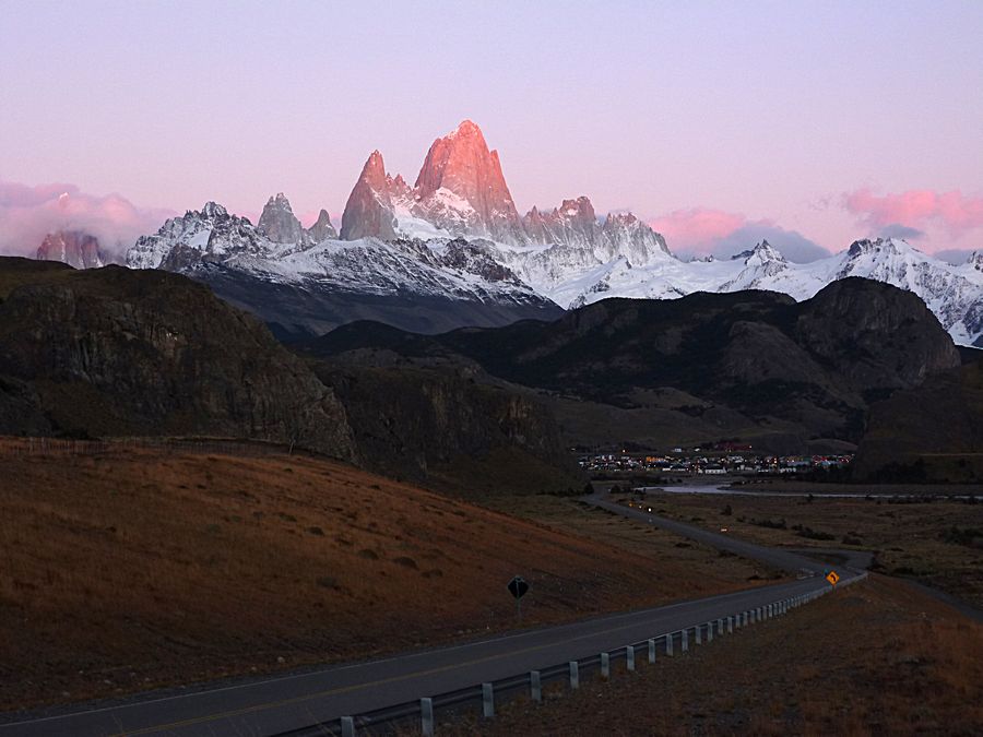
The morning of Feb. 16 we rose early to try to capture a sunrise view of Fitz Roy on our way out
of town, as we headed back to the town of El Calafate to catch a flight to Buenos Aires. This web page is
mostly but not entirely devoted to the changing views of Mt Fitz Roy and Mt. Torre that we were very lucky
to get. One of the things I love about nature and the mountains is that you get ever changing views based on
weather conditions and time of day.
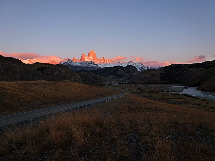
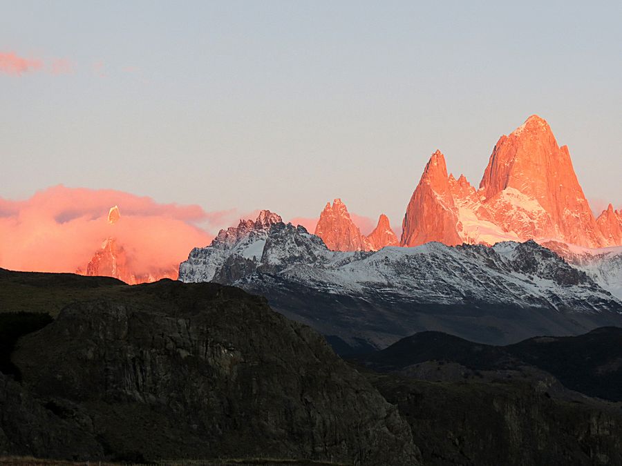
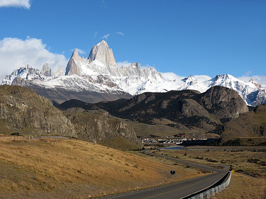
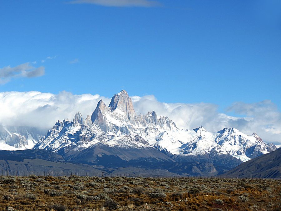
Sun rising over the town of El Chalten and Cerro Fitz Roy.
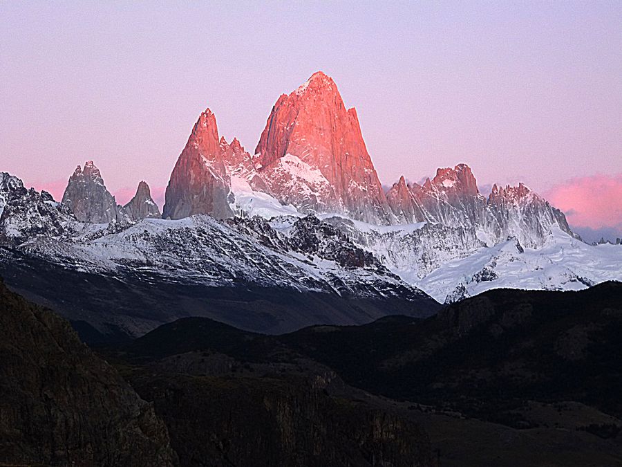
Cerro Fitz Roy Chalten is 11,168 ft. high. It was first named Chalten by the Tehuelche
natives of the area. In 1877, famous Argentine adventurer Francisco Moreno renamed this
mountain in memory of English sailor Robert Fitz Roy, a captain of the Beagle, in recognition of his
cartographic work during his survey of the coasts of Patagonia and Tierra del Fuego. In 1834, Fitz Roy
and Charles Darwin sailed up the Santa Cruz River hoping to reach the Andes, and they may have seen
this mountain to the west. When Moreno changed the name, he said the natives had also given the name
Chalten to other mountains, so he took the liberty of renaming it. For a long time Fitz Roy was thought to be a
volcano, because of the typical clouds that rise around its summit that were mistaken to be smoke and ashes.
The tall peak to the left of Fitz Roy is Poincenot, named after a Frenchman who died during the
expedition that eventually successfully reached the Mt Fitz Roy summit for the first time in
February 1952.
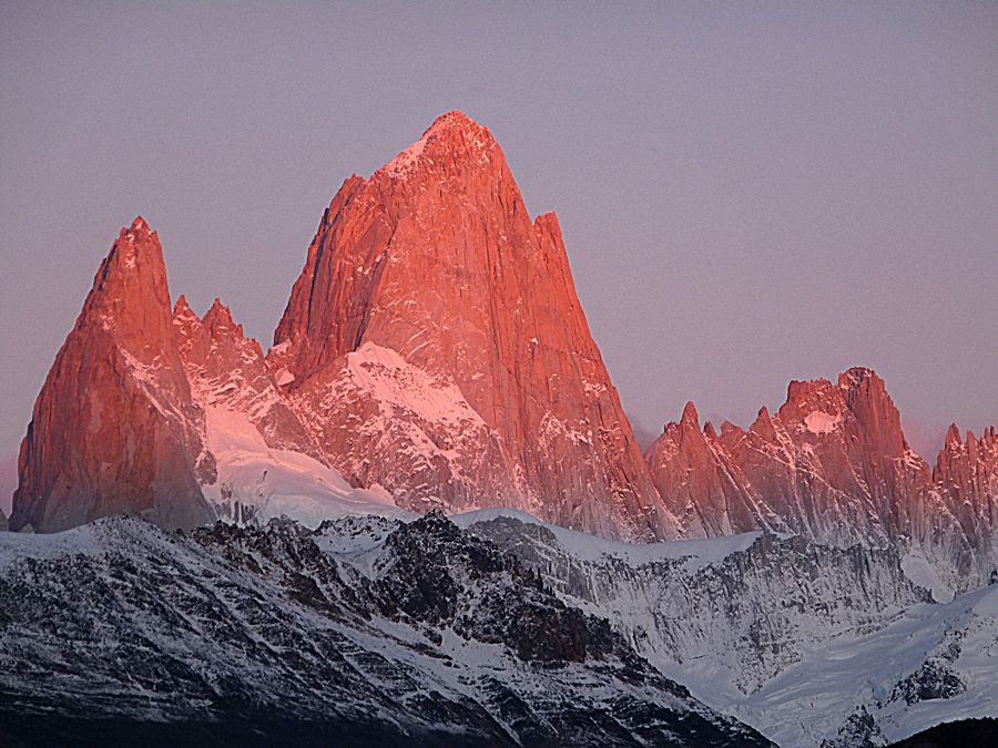
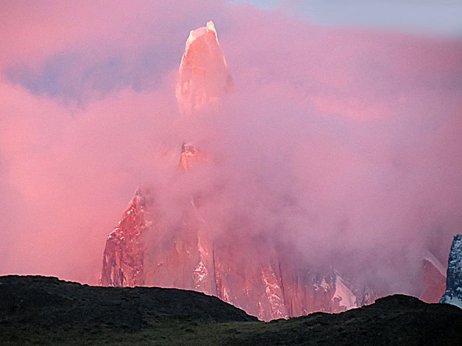
Cerro Torre, on the left, amidst the pinkish clouds. We finally got to see the top of it.
Cerro Torre is 10,175 ft. high. It became known to the Western world when Antonio de Viedma, an
explorer who traveled in the area in 1782 made out the Andes range at a distance. In his writings, he
wrote that at the bottom of a lake (now called Lake Viedma) there are "two rocks like two towers, one taller
than the other whose very sharp summits exceed all the neighboring hills in height even with no snow on them,
and which the natives call Chaltel..." He was referring to Cerro Torre and Cerro Fitz Roy Chalten. One hundred
years later, Francisco Moreno also described the mountain as a tower, and so the name Cerro Torre (Tower) has lasted.
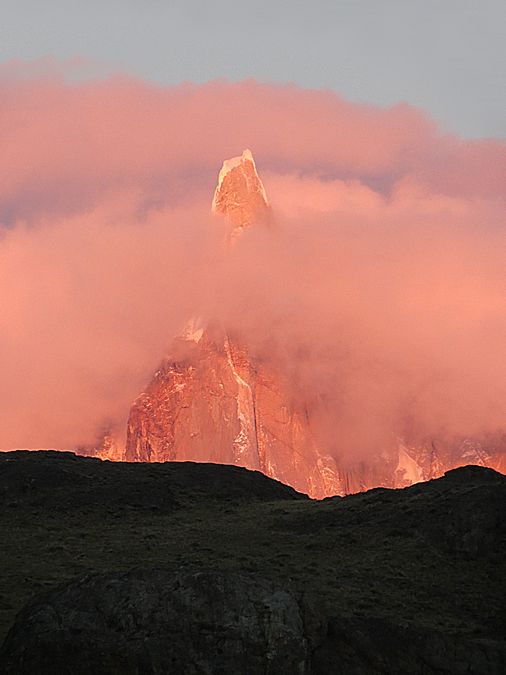
Another view of Cerro Torre amidst the pink clouds at sunrise.
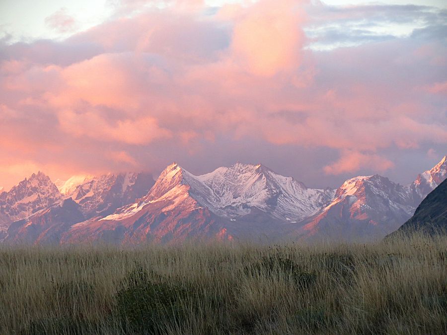
I briefly tore myself away from looking at Torre and Fitz Roy, looked in the opposite direction,
and saw these mountains at sunrise.
We stayed at the viewpoint until the sun fully rose. Cerro Torre became completely covered in clouds,
but Fitz Roy was still cloud free.
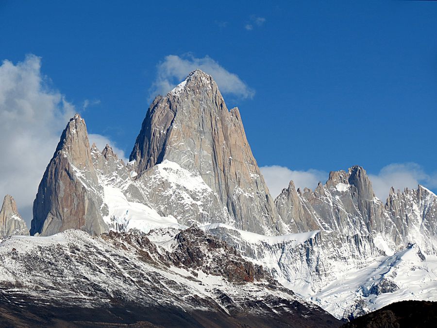
Fitz Roy closeup
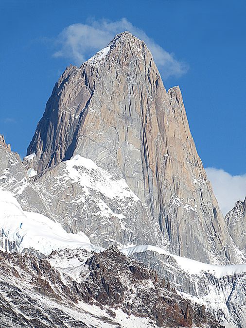
Fitz Roy summit
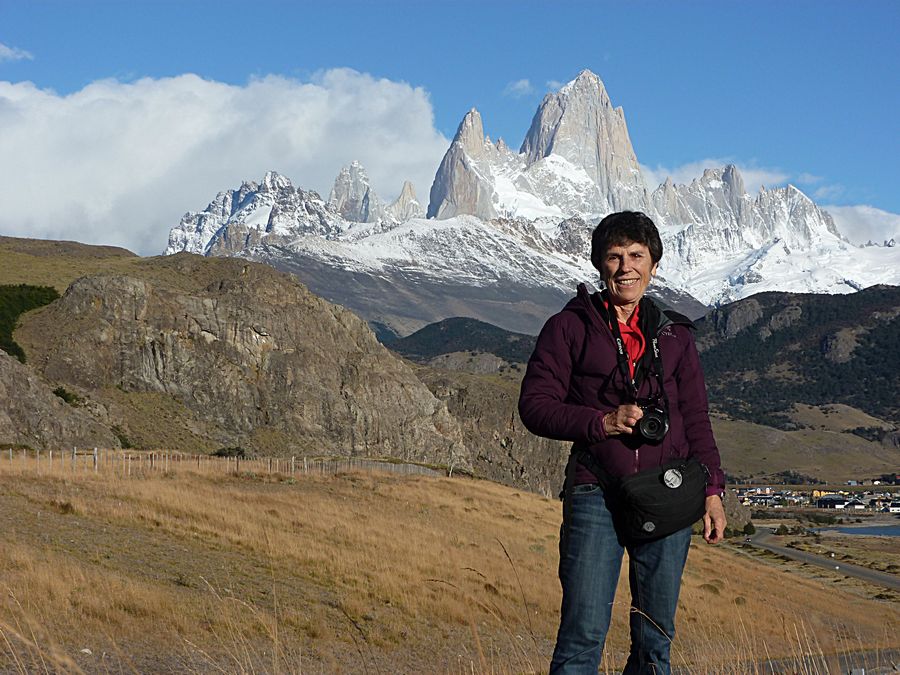
Jeff and I each took a photo of the other in front of Fitz Roy.
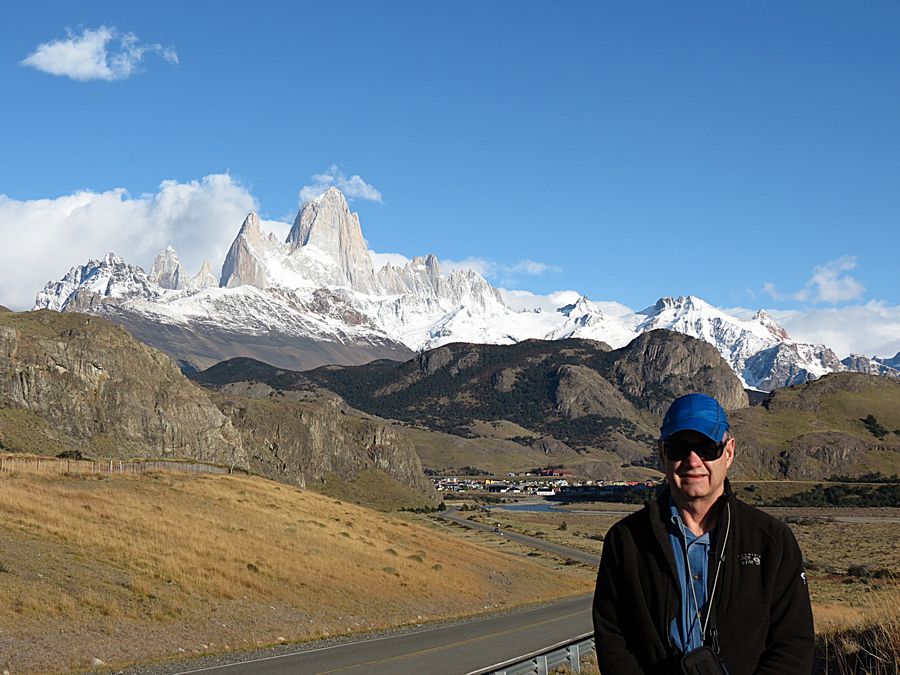
Jeff with Fitz Roy and El Chalten in the background
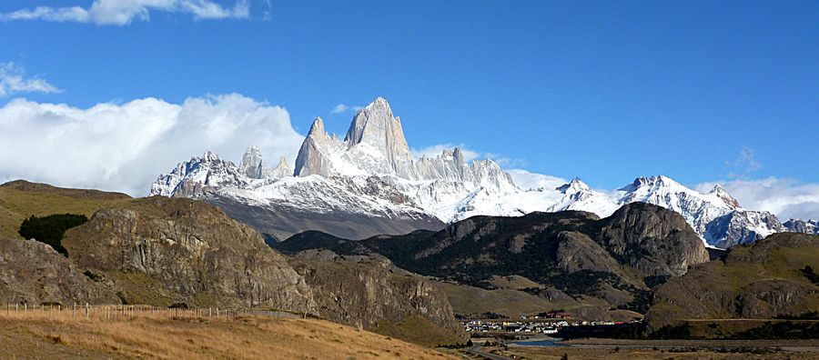
Panorama of Fitz Roy and El Chalten
Final view from this overlook before departing for El Calafate
Lake Viedma is a major elongated lake formed from melting glacial ice. It is fed primarily by the
Viedma Glacier at its western ends. The name of the lake comes from the Spanish explorer Viedma,
who reached its shores in 1783, the first European to do so. Although most of the lake lies in Argentine
territory, the western shores reach the Southern Patagonian Ice Field in an area where the border remains
undefined. Even if the Chilean territorial claims don't reach the shores, that could change as the glacial
tongue in the lake melts.
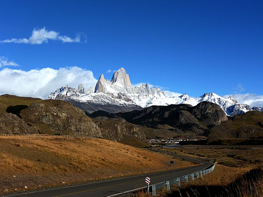
Fitz Roy fills the skyline as we drive toward El Calafate.
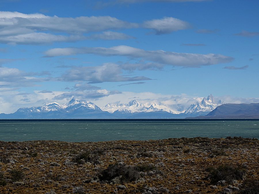
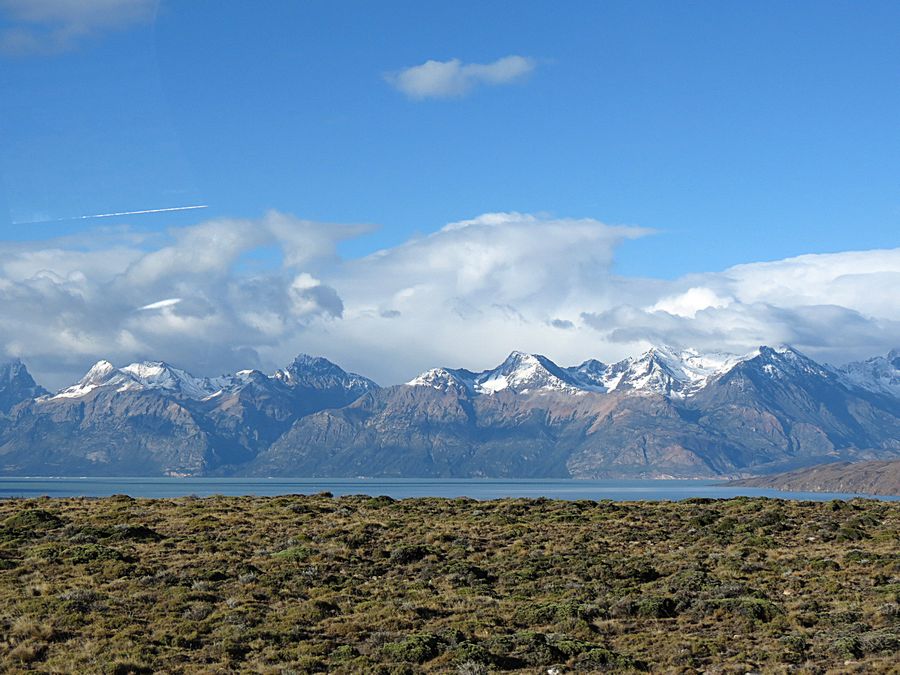
Another view of Lake Viedma and the Southern Andes
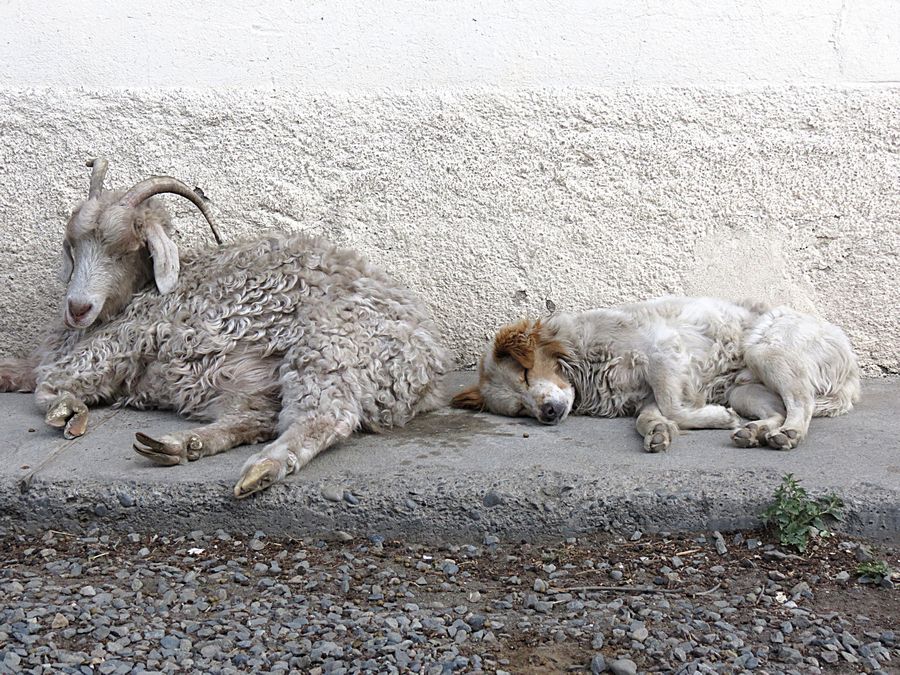
Two friends sleeping at the Hotel La Leona, the one time Butch Cassidy and Sundance Kid hideout,
where we stopped again for a rest break before proceeding to the El Calafate Airport.
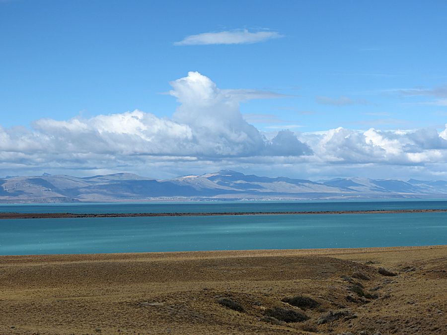
The green, glacial Lago Argentino with El Calafate in the distance, the largest freshwater
lake in Argentina. It covers over 869 miles with an average depth of 492 feet and a maximum
depth of 1640 ft.
It is fed by melting water from numerous glaciers, rivers, the water from nearby
Lake Viedman, and many mountain streams in the surrounding area.
Link to Page Seven - Buenos Aires
Pat's Home Page