ROUTE OF THE MAYA
November 9 - 26, 2010
Page Ten
Guatemala continued - Tikal National Park
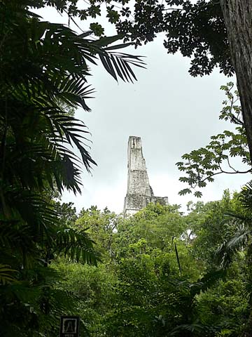
We flew to the town of Flores in northeastern Guatemala in order to visit nearby Tikal. Tikal's main structures were constructed from 550 AD to 900 AD. The structures include towering temples that are shrines to the imperial dead. At its height, the total urban area of Tikal was more than 62 square miles with a population between 50,000 and 100,000. It was first occupied around 600 BC. It was governed by a dynasty of 30 or more rulers from about the first century AD to near 900 AD. There is evidence that Tikal was conquered by Teotihuacan (in Mexico) in the 6th century AD, but a renaissance was achieved after Teotihuacan's collapse. Many archaeologists think the collapse of Tikal in the 10th century was due to overpopulation, that resulted in environmental destruction and drought. One of the largest of the Classic Maya cities, Tikal had no water other than what was collected from rainwater and stored in ten reservoirs. In the 5th century the power of the city reached as far south as Copán, the first Mayan site we visited in El Salvador. Copán was not in an ethnically Maya region and the founding of the Copán dynasty probably involved the direct intervention of Tikal. Filmmaker George Lukas used Tikal as a setting in his first Star Wars movie. Tikal has been partially restored by the University of Pennsylvania and the Government of Guatemala. It is the largest excavated site in the American continent. It took the University 13 years to uncover about 10 square miles of structures, but much of it is not excavated.
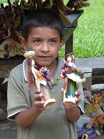
A child trying to sell us dolls near the entrance to Tikal. At
another place, I bought 4 necklaces for $1 each from a young
man, who looked to be in his late teens. After I paid him, he
said: "Thank you. You just paid for my lunch."
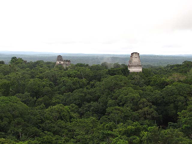
View from Temple IV of other temples (I, II, III) arising from the forest canopy. We walked up a long wooden
stairway to get to the top.Temple IV is the tallest temple-pyramid at Tikal, measuring 230 feet from the
plaza floor level to the top of its roof comb.Temple IV marks the reign of Yik’in Chan Kawil. Temple IV is the
largest pyramid built anywhere in the Maya region in the 8th century, and as it currently stands is the tallest
pre-Columbian
structure in the Americas although the Pyramid of the Sun at Teotihuacan may originally
have been taller.Tikal has nine groups of courts and plazas, separated by ravines but connected by causeways
and ramps. The free-standing pyramid was the dominant form used by Maya architects." It was an overcast
and rainy day during most of our tour of Tikal,
and we did get rained on at times, but we escaped the heaviest
downpour when we were eating lunch at a outdoor restaurant
at the site under a large canopy.
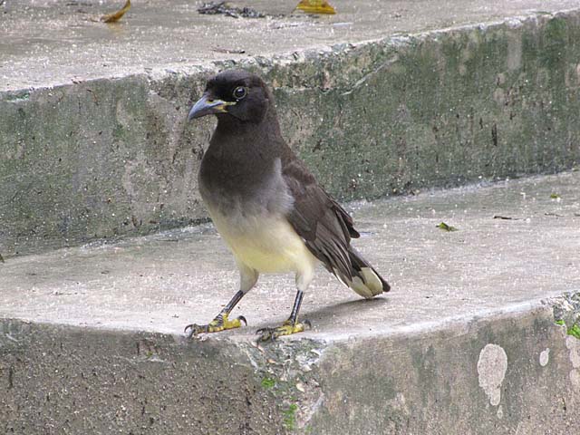
I don't remember the name of this bird, but it posed so nicely for me.
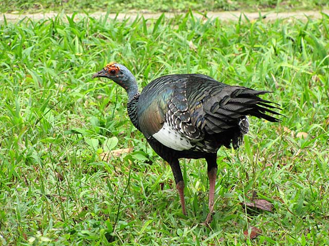
An ocellated turkey. We saw several driving to the main ruins area within the Park and also at the ruins.
The population of ocellated turkeys is threatened by illegal hunting and loss of habitat.
Temple III - about 180 feet tall. Also known as the Temple of the Jaguar Priest,
it was the last of the great pyramids to be built at Tikal.
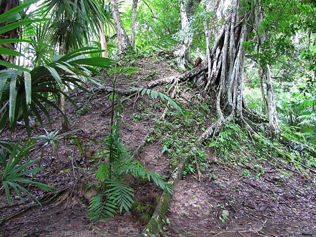
At Mayan ruins, one often sees mounds like this where ruins that have not been excavated are buried.
The forest surrounding Tikal includes many ceiba trees, the national tree of Guatemala and sacred to the Mayans.
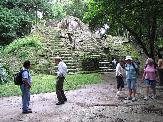
Another one of the many pyramids at Tikal. The World War II veteran on the tour, Arlyn, is the second
from the left. Heather, in the pink on the right, discovered that she did not have her passport when we arrived
at Lake Atitlan. The OAT tour leader of the
tour that was one day
behind us checked the hotel where we
had stayed in
Guatemala
City, and her passport was
found in the room safe of
her room.
He brought it with him to Lake Atitlan and turned it over to her.
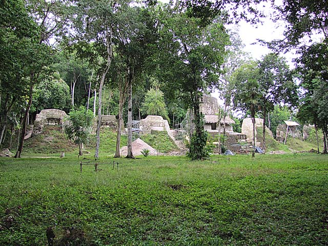
The Plaza of the Seven Temples. It may have served the function of passage
from a public space
into a ceremonial space.
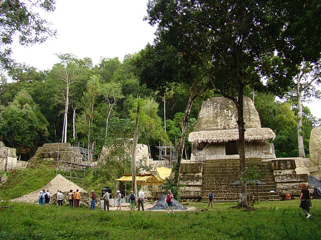
Another view of the Palace of Seven Temples
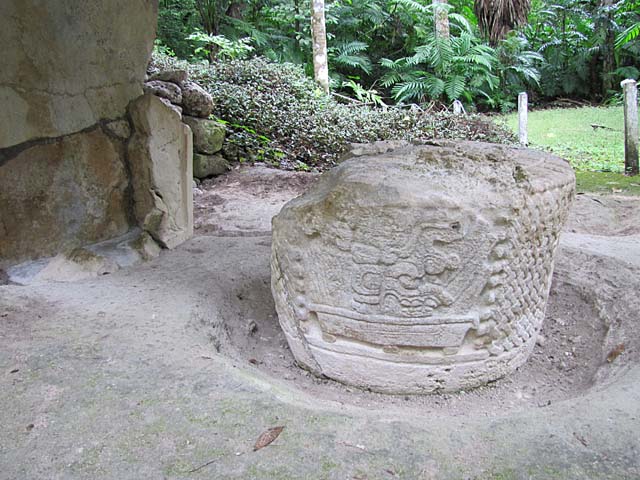
Stela on the grounds of Tikal
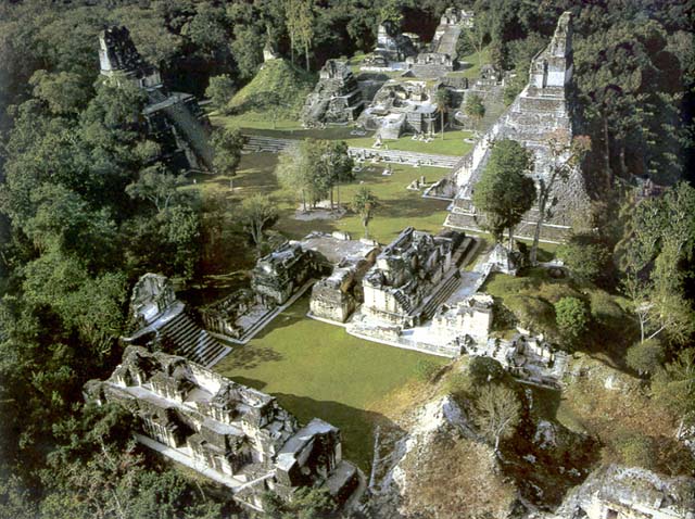
I found this photo on the Internet. It gives an aerial view of the great plaza area of Tikal.
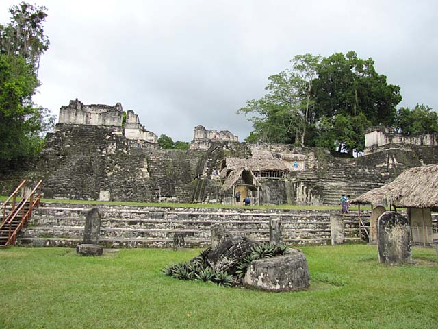
The North Acropolis. It developed into a funerary complex for the ruling dynasty of the Classic Period,
with each additional royal burial adding new temples on top of the older structures. After 400 AD, a row of
tall pyramids was added to the earlier Northern Platform, which measured 330 by 260 ft, gradually hiding it
from view.
Eight temple pyramids were built in the 6th century AD, each of them had an elaborate roof and
a stairway flanked by masks of the gods. By the 9th century AD, 43 stelae and 30 altars had been erected
in the North Acropolis; 18 of these monuments were carved with hieroglyphic texts and royal portraits.
The North Acropolis continued to receive burials into the Postclassic Period.
The pyramids at Tikal, are turned to face one another, and the rooms that were built at the top of the pyramid have
depressions in the stone walls that serve as amplifiers of the voice which are broadcast in all directions.
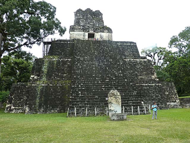
At the top of the pyramid the ruler acquired god-like qualities.This is Temple II on the Main Plaza.
The temple was dedicated to the wife of Jasaw Chan K'awil, although no tomb was found. The queen's portrait
was carved into the lintel spanning the doorway of the summit shrine.
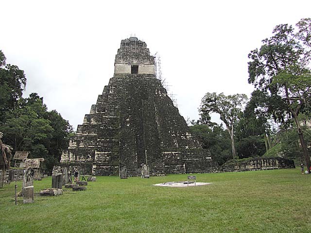
Temple I, the funerary shrine of Ah Cacau was built after his death, probably under instructions he gave to
his son and successor. Ah Cacau's tomb was discovered underneath the shrine, north of the centerline of
the pyramid. On its summit is a three-room temple surmounted by a huge roof comb portraying the ruler seated
on his throne. A carved wooden lintel inside the shrine depicts Ah Cacau seated before an immense jaguar-protector
deity, and records his inauguration.
Link to Page 11 - Tikal continued
Link to Page One of Route of the Maya
Pat's Home Page