Hiking in Patagonia - Chile and Argentina
February 2-18, 2013
Part Two - Argentina
Page Five - More Hiking in Los Glaciares National Park
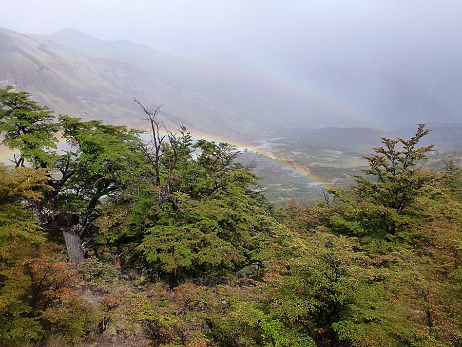
Double rainbow. The group headed out on Feb. 14 with the intention of hiking to Laguna Torre, a glacial lake
in front of Cerro Torre. It was raining rather hard, which allowed us to see this double rainbow at a viewpoint
from which you can see Cerro Torre in good weather. Most of the tour group decided to return to El Chalten
to explore the town rather than continuing hiking in the poor weather. Cecilia led that group back to the town.
4 of us, including Jeff and me, elected to continue hiking to the glacial lake with our tour leader Sergio.
It soon stopped raining, although it remained cloudy.
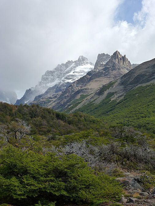
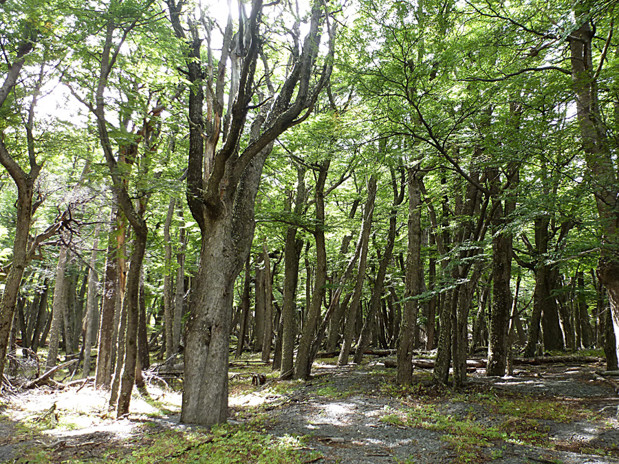
We hiked through a beautiful valley as well as through
beech forest. The mountain in the background is Techado Negro.
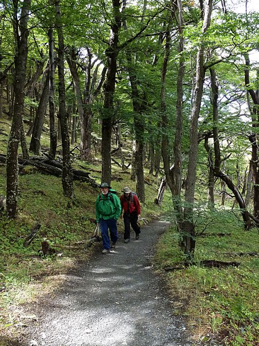
Part of the beech forest (lenga). Randy from Utah in front of Jeff.
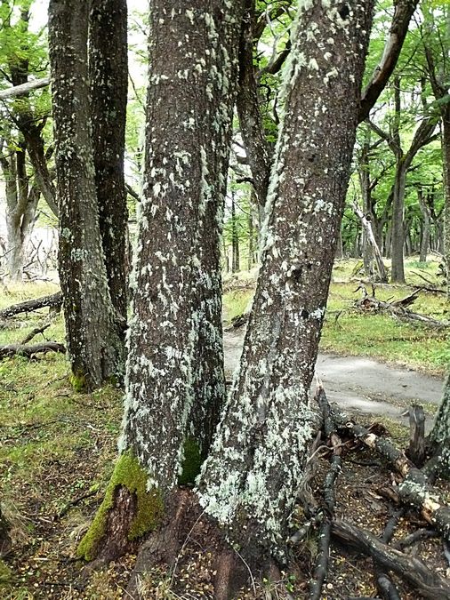
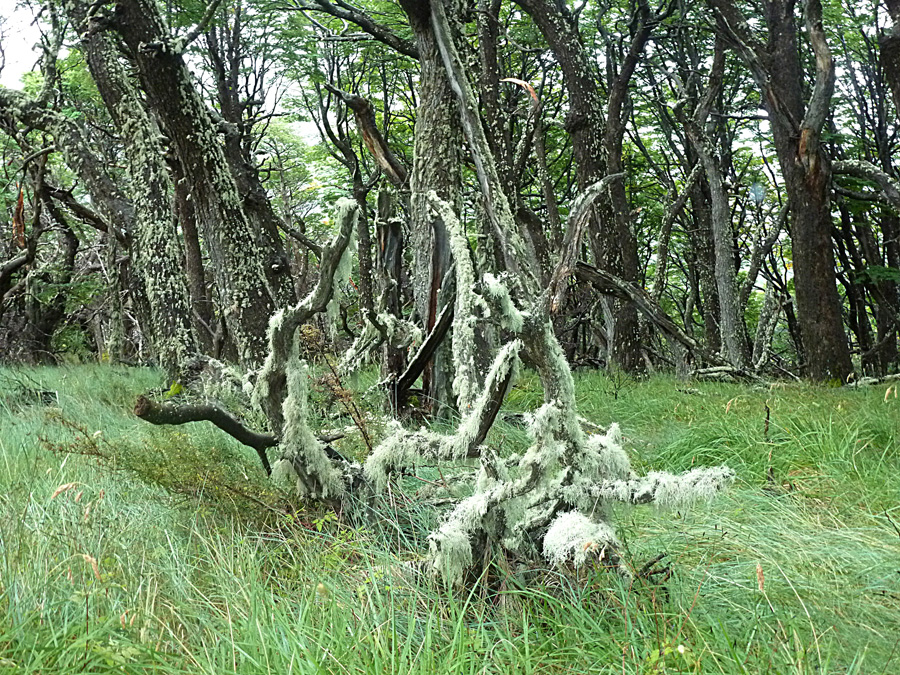
The forests in the Park are covered with Barba De Viejo,
or "Old Man's Beard." We loved Old Man's Beard.
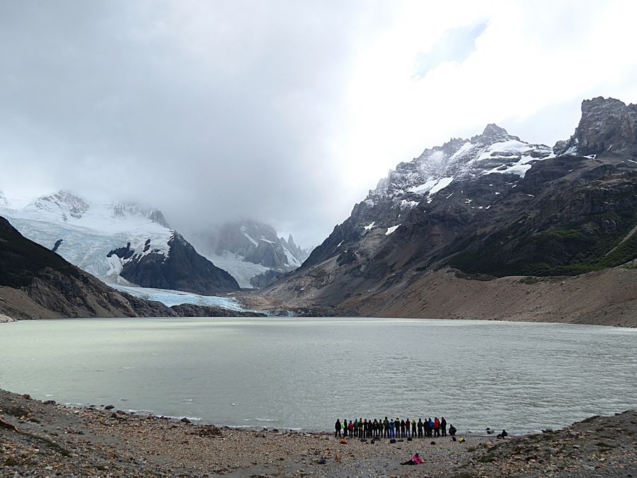
Our destination, the Laguna. We didn't see the top of Torre but the Laguna Torre is a beautiful spot.
While we were sitting near the lake, my backpack was picked up by the wind and starting to fly away, but
a tour guide from another group grabbed it and placed large rocks on it to keep it in place.
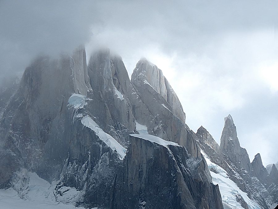
Closeup of what we could see of Cerro Torre, which is on the far left. Next to Torre is Egger,
next to Egger is Herron, and next to Herron is Standhardt. More on Cerro Torre later. Torre
Egger is 9348 ft. high, and this tower is named after Austrian climber Toni Egger, one of the most
famous climbers of his era, who died in 1959 in an attempt to climb Cerro Torre with Italian climber
Cesare Maestri. Punta Herron or Herron, 9020 ft. high, is named after Philip Herron, a climber from
New Zealand who died in 1976 on an expedition to Torre Egger. Cerro Standhardt is named after German
photographer, Ernst Standhardt, who visited the area in the 1930s in his Model T Ford, which he used both
as a home and as a photo lab. He lived in the area for over 30 years and extensively photographed the
mountains of the area.
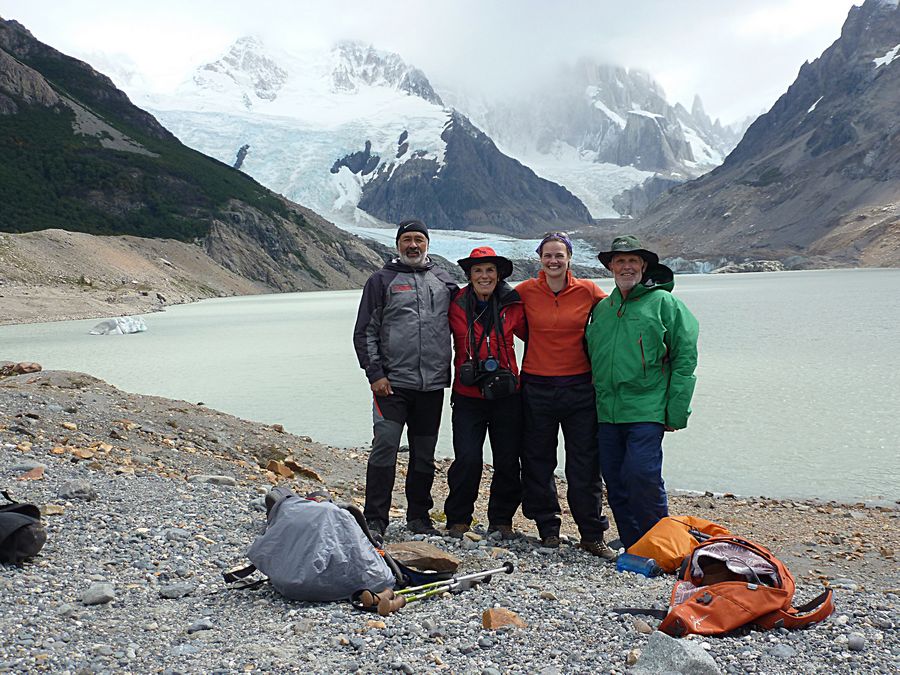
3 of the intrepid hikers who elected to do the whole hike with Sergio, who is on the left - Pat, Kelly, and Randy.
Jeff took the photo so he's not in the picture. Note that 3 of the 5 are from Colorado.
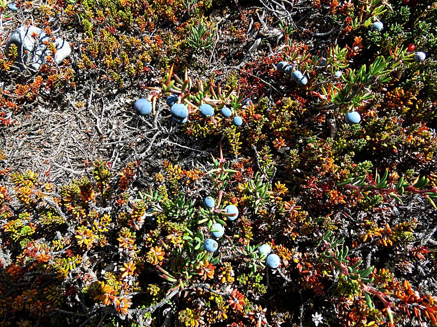
The Magellan Barberry, in Spanish called Calafate, is an evergreen shrub, with shiny, spiny leaves.
The Calafate is native to southern Chile and Argentina and is a symbol of Patagonia. The bush grows to
a height of 3 ft. 3 in. to 4 ft. 11 in. Its edible blue berries are harvested for jams, but are eaten fresh too, which
we did in both Chile and Argentina. There is a legend that anyone who eats a Calafate berry will be certain
to return to Patagonia.
Jeff loved the lenga forest. Lenga Beech or Lenga is a deciduous tree that is native to the
southern Andes range, in the temperate forests of Chile and Argentina. In southern Patagonia,
it grows to a height of up to 100 ft., and can attain a trunk diameter of 5 ft.
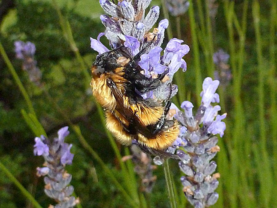
Another busy Patagonian Bumble Bee clinging to a flower during a wind gust.
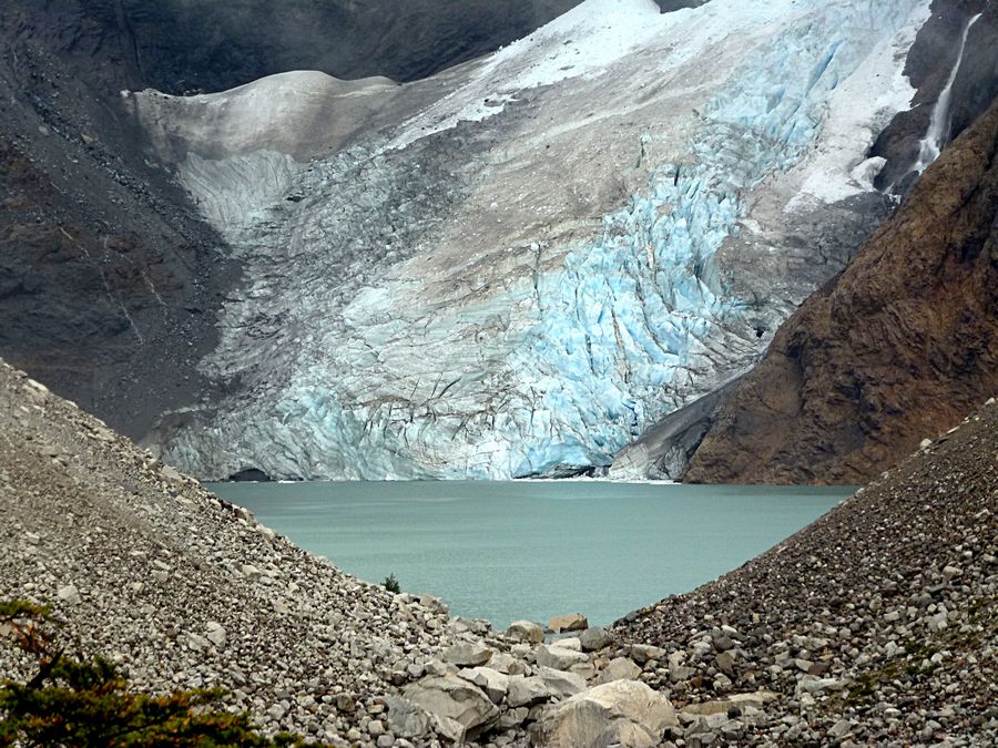
The following day, Feb. 15, we did our last hike in Los Glaciares National Park. It was again
rainy in the morning when we were hiking, but it cleared up as we got back to El Chalten. This is
the Glacier Piedras Blancas. The Lake is Lago Piedras Blancas.
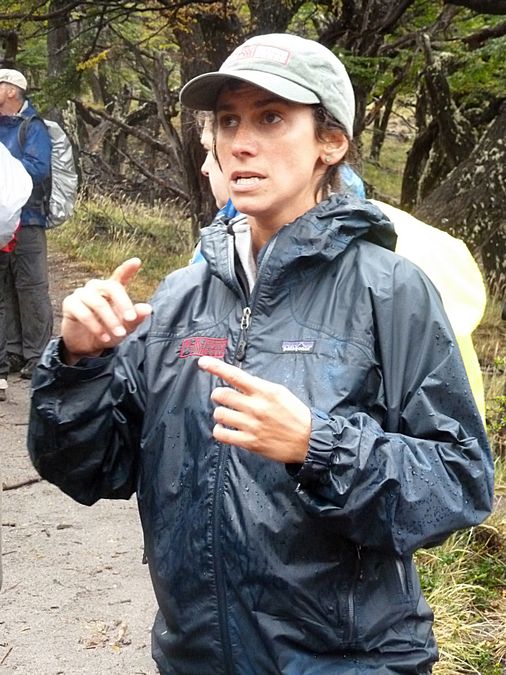
Cecilia talking about the glacier. Like many from Argentina, she has an
Italian background. When she is not a tour guide or mountaineering, she
is a math teacher in a local school. She has a degree in physics from the
University of Buenos Aires. She has climbed Fitz Roy, one of the most
difficult climbs in the world. Nevertheless, she fell on a tree root and
injured her knee during this hike. She continued hiking, but the knee
did swell up.
More Old Man's Beard clinging to the trees (lenga) in the forest.
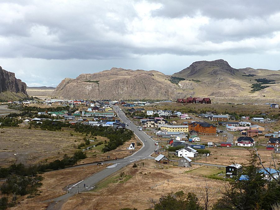
View of El Chalten. We stayed 2 nights in the Hotel Destino Sur, which is the light brown building with dark roof
to the right of the yellow building in the center right of the photo. El Chalten is a small mountain village
in Santa Cruz Province. It is located in the river valley Rio De las Vueltas, within the Los Glacieres N.P.
at the base of Cerro Torre and Cerro Fitz Roy mountains, both of which are popular, very difficult climbing
destinations. For this reason, this village is well-visited by both trekkers and climbers. The village was built in
1985 to help secure the disputed border with Chile. Today the sole reason for its existence is tourism. The town
is removed from the normal flow of news and communication, even during high season (November-February), and it
is nearly deserted during off-season.
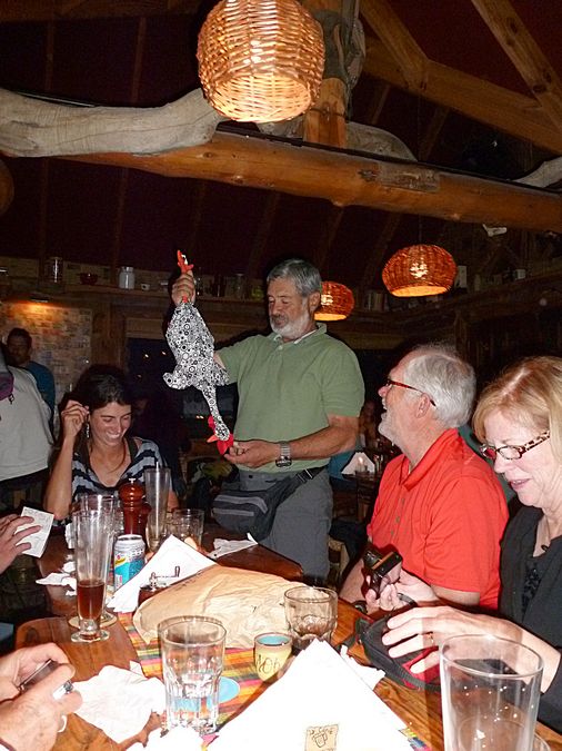
Although we had another night and day in Buenos Aires,
we had our farewell dinner in El Chalten to say goodbye to
local guide Cecilia and tour leader Sergio. As a gag gift,
Sergio was given Super Pollo, a slightly stuffed chicken.
Rand and Sharon from Utah are on the right.
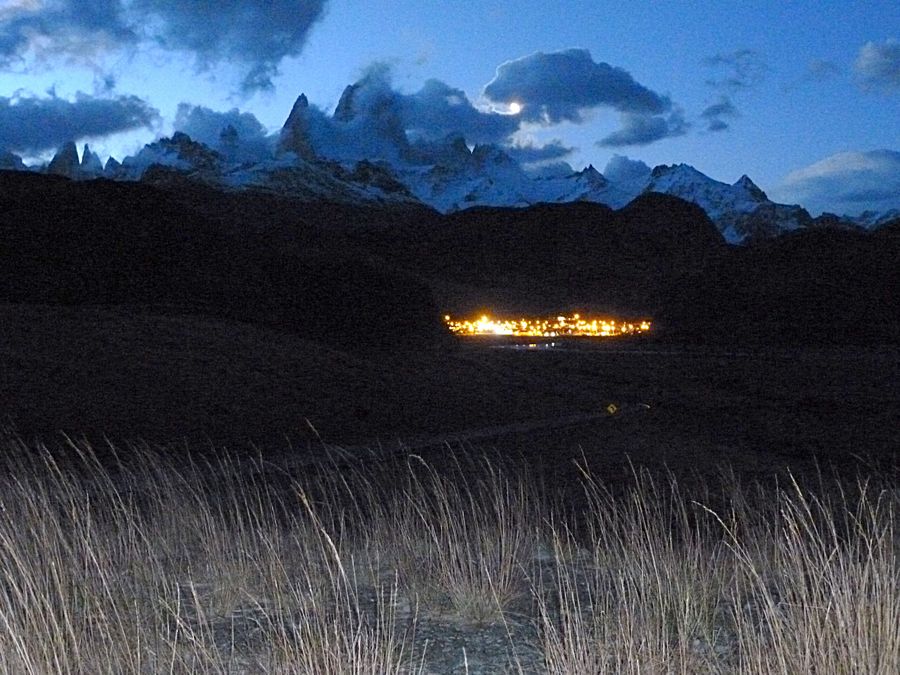
Since the sky was clearing, after the farewell dinner, our van driver drove us a short way out of town
to the Fitz Roy viewpoint for a night view of Fitz Roy. We saw Fitz Roy and Cerro Torre with the moon
peeking through the clouds to the right of Fitz Roy.
Link to Page Six - Sunrise over Fitz Roy & Return to El Calafate
Pat's Home Page